Trail development along Hengifossá

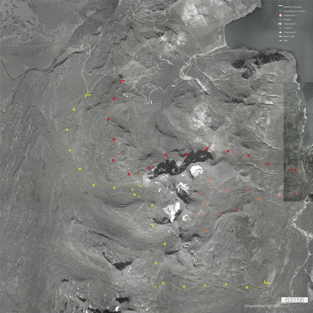
From the early 2010s, the trails along the Hengifossá have been gradually developed. The ambition has been to preserve the landscape and keep the changes to the trail, resting places and viewpoints to a minimum.

Since 2017 ZIS AS // ZeroImpactStrategies has been involved in the implementation, after having won the competition for the Tourist facilities at Hengifossá.

The different trail elements from the winning proposal were designed for production and placed strategically in the landscape. On a field trip in October 2017 the accurate positions were decided upon on-site. A set of guidelines also contained suggestions for the rehabilitation of the different parts of the trail. This strategic document was done in collaboration with Landslag, award-winning Landscape Architecture office based in Reykjavík.

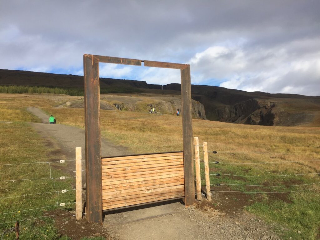
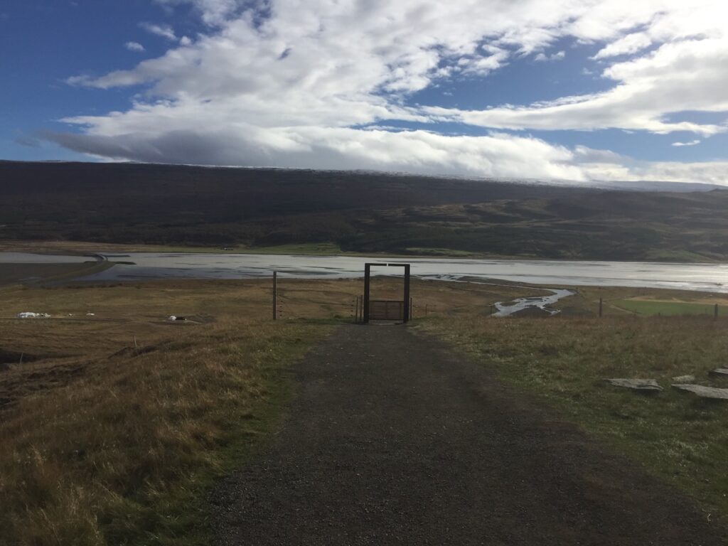
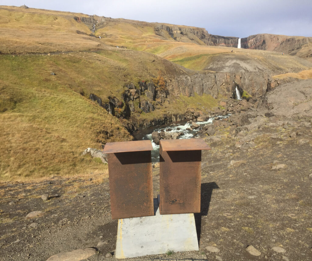
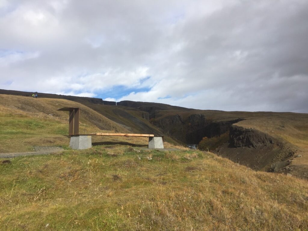
During autumn 2017 and spring 2018 the trail elements were installed in the landscape, and the trail rehabilitated. In September 2018 there was a new field trip to review the work done – the different design elements (benches, signposts, small bridges and gates) had all been installed. The illustration boards, to be mounted on the benches and signposts, was the only remaining items to be installed.

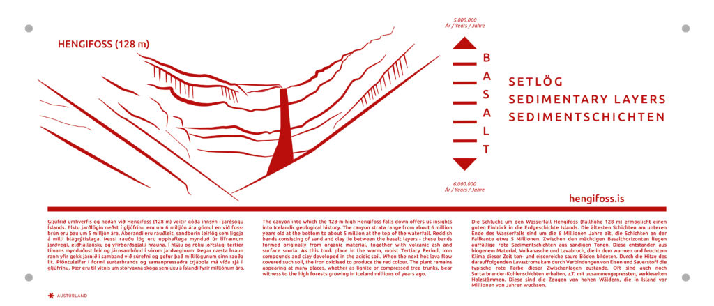
The illustration design was a part of a separate project, to better inform the visitors of the unique landscape and sights in Fljótsdal and surroundings. This project was supervised by Skúli Björn Gunnarsson. This information strategy would also be integrated in the new service building as a permanent exhibition.

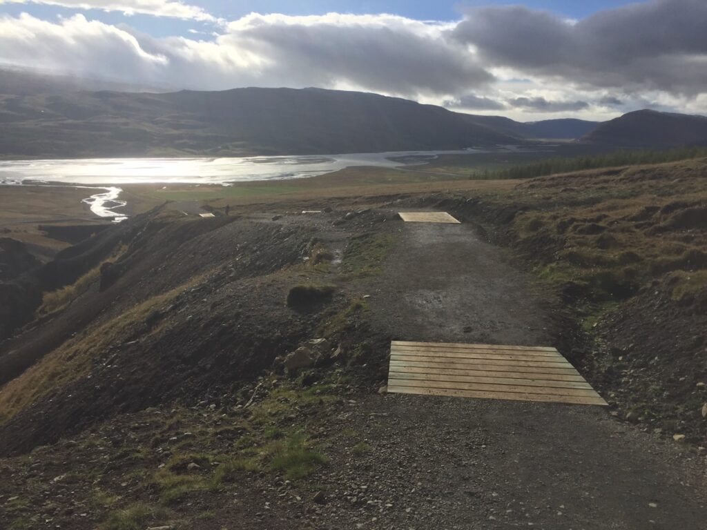
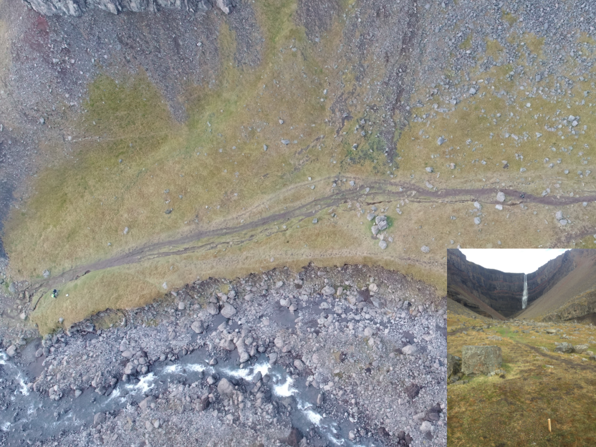
In spring 2019, because of extremely wet weather and an ever increasing number of visitors pre- and post-season, the trail up to Hengifoss had to be closed to prevent severe damage to the landscape. Subsequently the trail had to be repaired and protected, by installing wetland bridges in the uppermost chapter of the trail towards Hengifoss.

The number of tourists to visit Hengifoss had increased from  a mere 27 000 per season, from May to September in 2013, to a massive 83 000 per season, from March to November, in 2019. There was a dire need to build better facilities (a service building) by the car park. But with the out-break of covid in spring 2020, the visitors numbers fell for the two successive years (2020 and 2021) which delayed the start of the construction of the service building until 2022. 

In this covid-period, waiting for the tourists to return, the work began to extend the trail network on the opposite side of the Hengifossá. This diversifies the movement and thus reduces the impact of the visitors on the landscape.

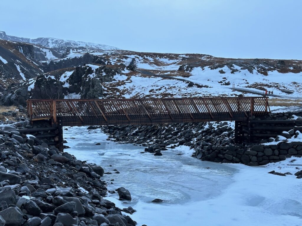
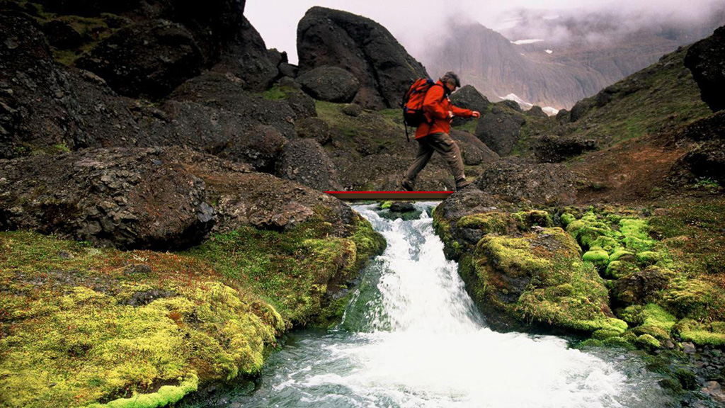
To connect with the existing trail, two bridges were designed and installed in autumn 2022; the lower at the start of the trail near the parking lot; the upper at a narrow point of the river, crossing a characteristic gorge. The bridge design and implementation was done by EFLA, with aesthetic input by ZIS AS // ZeroImpactStrategies.

Both of the bridges being wooden constructions, the lower bridge has a traditional wood railing. The upper bridge , due to its prominent location with high visibility in several directions, has a light railing to blend in with the landscape and not to obstruct the sight-lines towards Hengifoss.

The latest developments of the trails, and news of the construction of the service building, was duly presented on the evening news by Icelands main broadcaster RUV on the 01.07.2023 (from which the photo of the upper bridge has been taken).

Better facilitation for visitors at Geysir

«Kongsstien» is made up of minimal conceptual strategies – lifting the ground somewhat here, placing something lightly on the ground over there – in such a way that the magic of the place is preserved and that future kings may come to visit, be fascinated and leave again, just a little bit wiser.«

The proposal was made in collaboration with Handegaard Arkitektur.
G_1

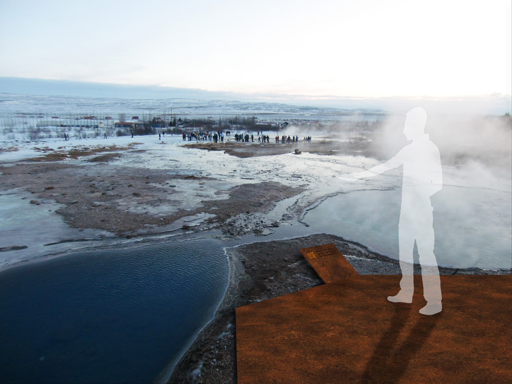
«Kongsstien» – coming as a stranger to a place of such awe, breathing and seething – at Geysir it really feels like you are closer to mother earth as a living, breathing entity, and that you are closer connected to her. To change a landscape like this demands respect, and the changes must reflect and subordinate itself to the existing – if not the Geysir area will loose the uniqueness of its connection to the inner earth. «Kongsstien» is made up of minimal conceptual strategies – lifting the ground somewhat here, placing something lightly on the ground over there – in such a way that the magic of the place is preserved and that future kings may come to visit, be fascinated and leave again, just a little bit wiser.
G_P1

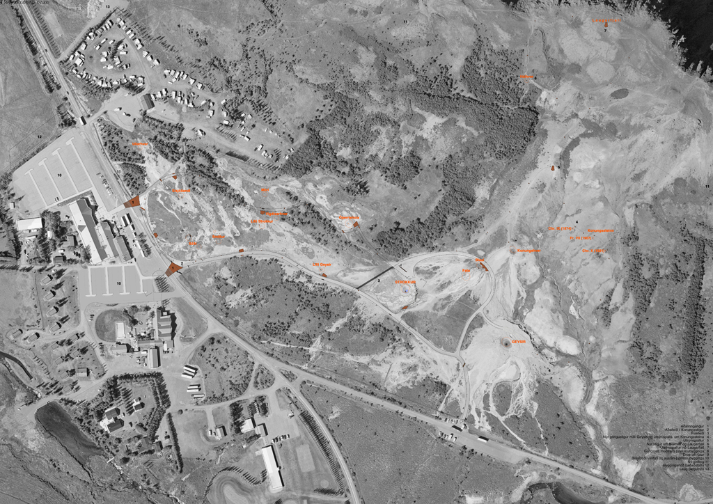
UNDERSTANDING OF PLACE // The Geysir area is today characterized by step-by-step development and no unifying impression that greets people. The extent of the conurbation is in the competition proposal defined by a new public bath on the western edge of the main parking, partially entrenched in the landscape. This gives a two-sided access and thereby better use of the main parking lot. The entrance to the parking lots are placed as early as possible, both to the east and west. This enhances the public flows securitywise, and leaves a minimum of vehicular traffic at the crossing points at Geysistofa. The two main entrances to the geothermal area defines a shared space, where vehicular traffic and pedestrians are mingled.
G_3

The deserted farm Laug can be redeveloped for tourist rental with a strong focus on environmentally friendly tourism as a self-sufficient summer cottage complex. This would be a perfect advertising board for similar deserted farms in more spectacular secluded locations, self sufficient in the same way. The fence surrounding the geothermal area is repositioned to the west, when the shortcut from the camping site is integrated into the pedestrian system of the geothermal area. The fence is also repositioned so that you can reach the top of the Laugarfell mountain still within the perimeters of the geothermal area. Ticket sales are handled either in the service centre or through ticket machines on the southern side of the road close to the parking lots, thus preventing large concentrations of people out in the road. Automated entrance control with ticket scanning further facilitates quick access to the geothermal area on the northern sid of the road. The ticket system will be adapted to the national strategies for payment at tourist sites in the Icelandic landscape – i e the «naturpass».
G_P4

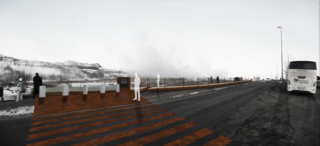
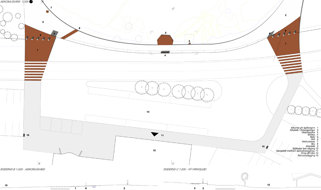
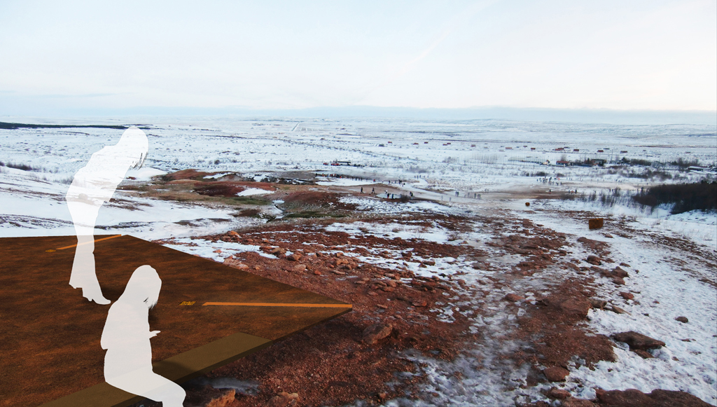
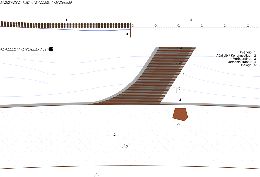
ENTRANCE TO THE AREA // From the big parking lots you move as a pedestrian unhindered along the service centre, whether you come from the west or the east you can choose either between the existing or the new entrance. Two «surfaces» come down from the geothermal area and invite you in, made from cor-ten steel plates embodied in the asphalt. They split to individual lines as pedestrian crossing and continues into the geothermal area as one continuous plate. The new crossings defines a quieter zone where toueist busses has their drop-off zones and vehicular traffic in general is kept on the pedestrians terms. A continuous pedestrian zone binds the two crossings and the entrance to the service center together, as well as the materiality of the shared space is changed to slow speed and indicate that the pedestrians are prioritised.
G_P5

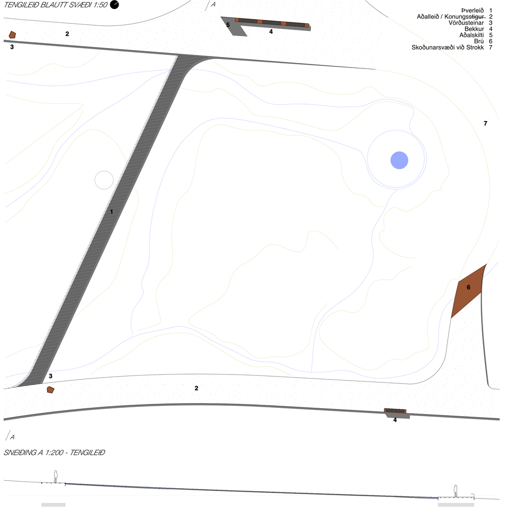
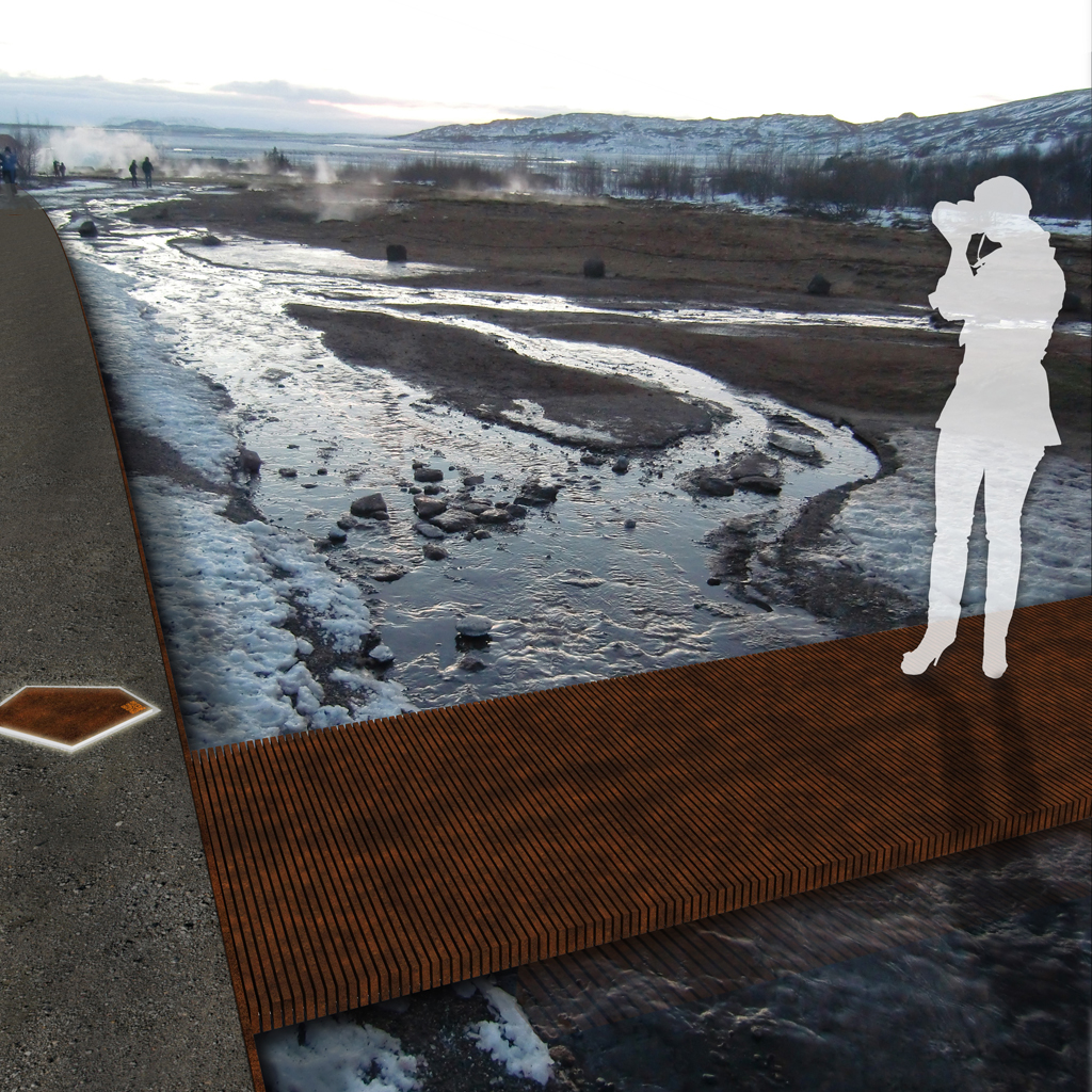
FLOWS WITHIN THE GEOTHERMAL AREA // Within the geothermal area is established a new ring road, and by positioning the new pathway on the northern side of Thykkvihverir you get a better overview of all the smaller pots here. In addition the new pathway gives access to the hotter springs which you can´t reach today. The ring road is water heated and ice-free, and makes a relief to the ground made of sandblasted concrete, with aggregate of the same colour as the on-site sand and gravel. A secondary crossing path is executed as a cor-ten steel rib structure also water heated by the flexible pipes which binds the ribs together – these ribs functions as an ice-free carpet laid out over the wet areas and let the overflowing water run through while you pass over dry. The paths to view-points, Laugarfell top and the Kings rocks are visually enhanced with abstract cor-ten «rocks» as guiding rocks as markers.
G_5

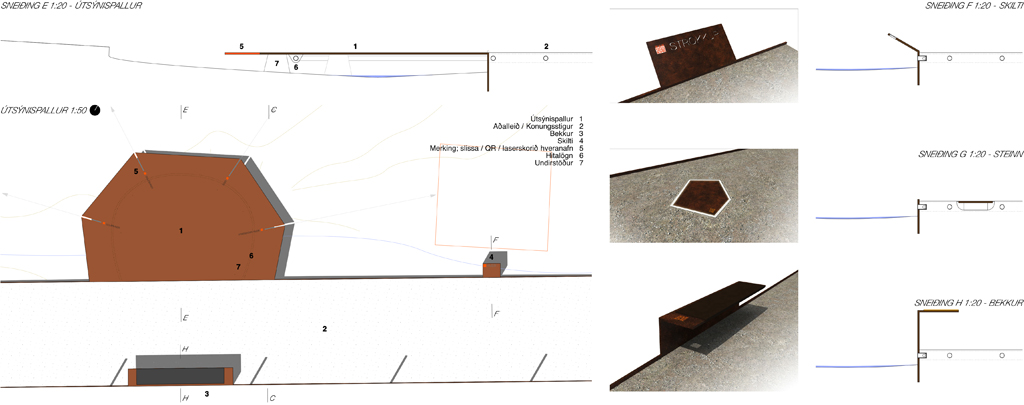
ELEMENTS // The ring road: surface relief in sandblasted concrete with cor-ten steel edge as guide line. / Secondary crossing: «carpet» og cor-ten steel rib structure./ Sightseeing platforms: Cor-ten steel plates with slits marking directions to springs / Bridges: Cor-ten steel plates covering small streams where they cross the ring road./ Main sign: Bigger cor-ten steel plate vertically extended from the edge with area description. / Signs: Tilted signs made of cor-ten steel plates, attached to the edge. / Bench: Cor-ten steel edge extended and bent to facilitate sitting with a / Guiding rocks, embodied: embodied cor-ten plates with edge illumination / Guiding rocks, free standing: Cor-ten abstract rocks along secondary paths / Fence towards the road: The Cor-ten edge is extended to form pillars for steel mesh.
G_P3

The new ring road forms a new loop which circumferes the hot spring Blesi. All elements attaches themselves to this new main loop – the sightseeing platforms are bent out from the edge, the benches and signs are extended and bent from the edge, the guiding rocks are embodied into the road surface or placed onto the terrain guiding along the secondary paths. The crossing south of Strokkur is also a highly visible secondary path, which functionally lets the water run through and under it. The pathways to Konungshver / viewpoint / Konungssteinar / Háihver / Laugarfell are less used and the free-standing rocks are enough to guide the visitors through the landscape and prevent damage to the terrain.
G_P2

MATERIALITY // Few, but robust lasting materials, are chosen to blend into the surroundings and avoid greater visual impact. «Gravel roads» made from sandblasted in-situ concrete, with aggregate of locally collected materials to further blend into the landscape. The ring road is percieved as a relief to the slightly undulating landscape. Water pipes run through the pathways, thus preventing ice and slippery conditions for unprepared visitors. Cor-ten steel as contrast material makes up the edges / wetland paths / sightseeing platforms / signs / benches and guiding rocks. Flexible water pipes are also used as the structural element for the cor-ten steel ribs of the wetland pathways, and underneath the sightseeing platforms. Fluorescent painted text and lines / QR-codes as visual contrast for signage and presentations.
G_2

COMMUNICATION AND EDUCATION STRATEGY // To avoid many large signs with plenty of text scattered around the area, it is suggested to place one main sign at the entrance / exit points which explains more thoroughly the geology and history of the geothermal area with written text. At every point of interest there are instead placed name-signs with an additional unique QR-code that takes you to a web-site with more specific information about each hot spring. Such an interactive digital solution is also more suitable to use educationally, where for instance school classes can use the web-site both for preparation and post visit assignments and information gathering. The QR-codes are painted on transparent plastic plates, embodied into the cor-ten metal signs, so that they are changeable if needed.

Dyrfjöll Stórurð

DS bridgeOn monday the 28. october 2013 Eirik Rønning Andersen / ZeroImpactStrategies received 1 prize in the open ideas competition for better facilities for hikers at the Dyrfjöll – Stórurð mountain area in the eastern part of Iceland. The consistent design concept, identified throughout the range of elements, was decisive for the jury when choosing the winner. The prize seremony at Egilstaðir included the presentation of the project to the public, as well as an interview with the icelandic national television, which went on air on wednesday 30. october. The day was also used effectively to have project meetings and a site visit.

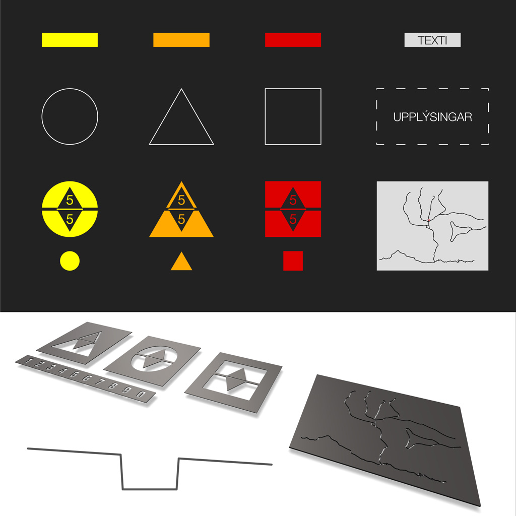
DS hiking trailsThe hiking trails are revised in the way they are marked and connected. Three main paths goes through the mountain range, differing in difficulty and length. Each path is given a distinct colour and a base form as identification, and secondary trails connecting to a main path shares its base form, but not the colour. Along the trails there are indications of distances for every kilometer. Adding as little as possible, and only when necessary, is the basic implementation strategy.

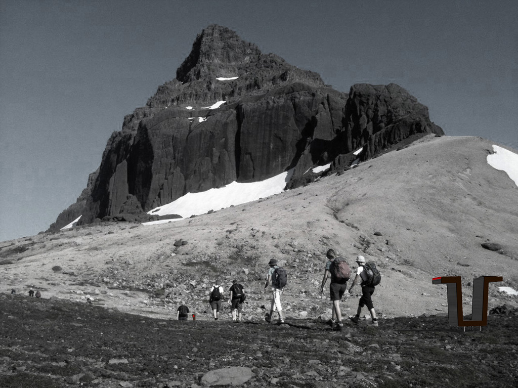
DS markingsThe smaller elements includes sticks, guiding lines, natural stairs and signs. They are applied where needed to make the path more visible, prevent unwanted movement, facilitate easier access in loose terrain and to give clear directions and other trail information at connections between the different paths. The signs may also be used at particular viewpoints along the trails.

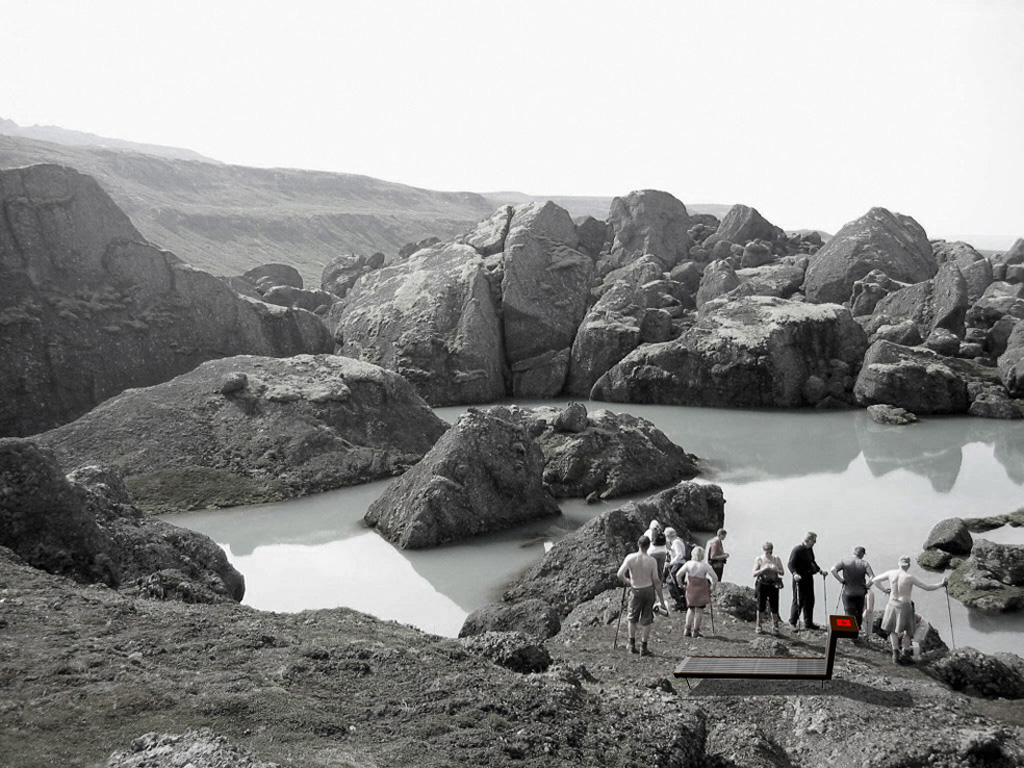
DS smaller itemsThe bigger elements are bridges, benches and wetland passings. The elements are constructed by a wooden rib structure, which gives a rigid frame and at the same time dries up quickly, thereby giving a non-slippery walking surface and a comfortable sitting surface. Combining elements (signs included in the benches) to reduce the number of elements and thus the impact on the area.

DS bigger itemsAt the starting points of each main trail there is placed new sanitary facilites, benches and terraces. These starting points will advertise the paths better towards the road network, and are thought to be used as supplementary services also for motorists. Ideally there can be set up smaller paths, accessible for all, in close proximity to the new starting points, linking the scenic vistas and the lake at Vasskarð, the mountain pass between Fljótsdal (Eyar) og Borgarfjörður.

DS starting pointThe main material of the project is wood, naturally weathered. Darker heat-treated wood forms the signature profile edge of the elements. Due to extreme harsh weather conditions at one of the starting points there were discussed some alterations in the materials to better withstand the strong winds / sandstorms. The signature edge, sticks etc might therefore instead be implemented with corten-steel, for better durability.

DS signsThe preliminary milestones for the project are: application for funding and public decision-making in the last part of 2013 / beginning of 2014, detailed elaboration and production during spring 2014, and execution of the project into the area summer / early autumn 2014. Due to a very short period without snow in the area in the summer time, detailed project planning is of great importance to be able to execute the project in a very short time frame.

DS benches

Motto Aqua

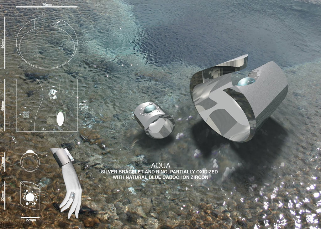
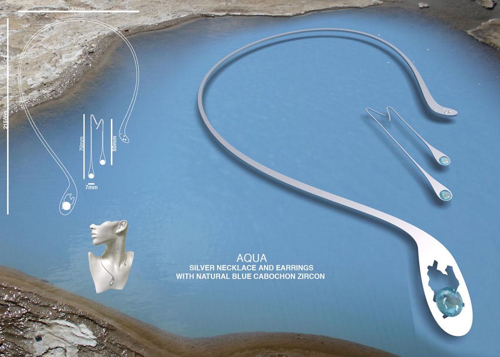
AQUA1_1024AQUA2_1024In collaboration with Sigridur Anna Eggertsdottir I participated in an open design competition arranged by the Iceland Design Center and jewelry designer Hendrikka Waage, our approach was to create asymmetry and capture the feeling of water…

The proposal came in third of just about 120 entries. The bracelet design was considered the competitions best, suitable also as a concept for a ring design. Our presentation was given great acclaim; obviously the jury liked it a lot.

Present at the seremony in Reykjavik were jury members Steinunn Sigurðardóttir, Icelands greatest fashion designer and Reykjavik City Artist of the year 2009, and Geoffroy Medinger,UK Brand director for Van Cleef & Arpels

Krissi from Krads received the prize on behalf of us.

See also extensive coverage from the prize seremony on icelandic TV here (in icelandic).

Motto 09975 Jellinge

J_perspective1In Jelling the Danish history is visible layer by layer of continuous activity, all the way back to the earliest of days – some layers still intact while others transformed, reused or moved and others still completely removed. In the community planning these elements are looked upon as references and for inspiration – Jellinge is a place of dynamic development and not the status quo.

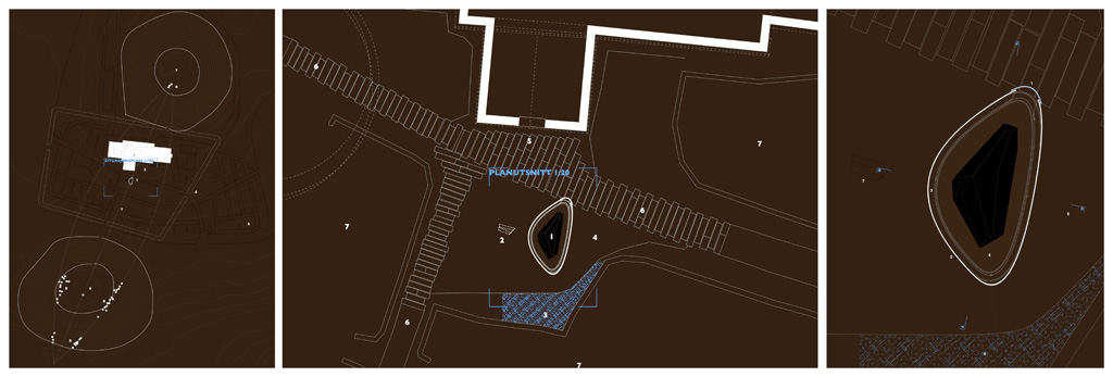
J_plansThe rocks are in fact just blocks of granite – its the carved signs on them that give the symbolic value far greater than the mere impression of them. They occupy both a greater physical and metaphysical space – their stories of the place, the people and the land. The aura of the rocks is charged with symbols that will bring wonder and enthusiasm to generations to come – it would be unique and bind together the history with the present and point towards the future. The aura, with its artistic expression, places a new layer on top of the already existing ones and hint towards the past use of colour to enhance the stones´ message. It plays with the changing light of the different seasons.

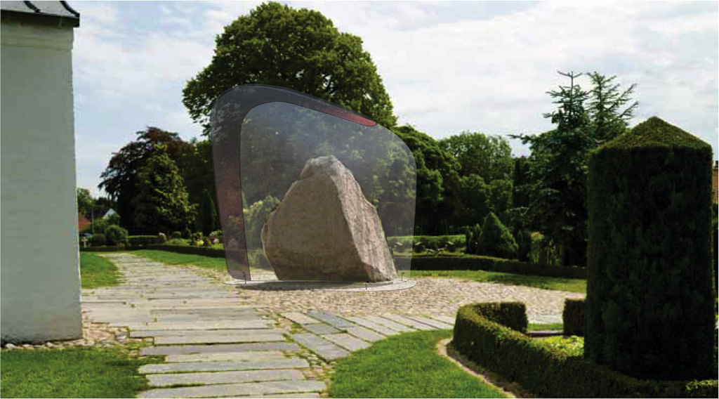
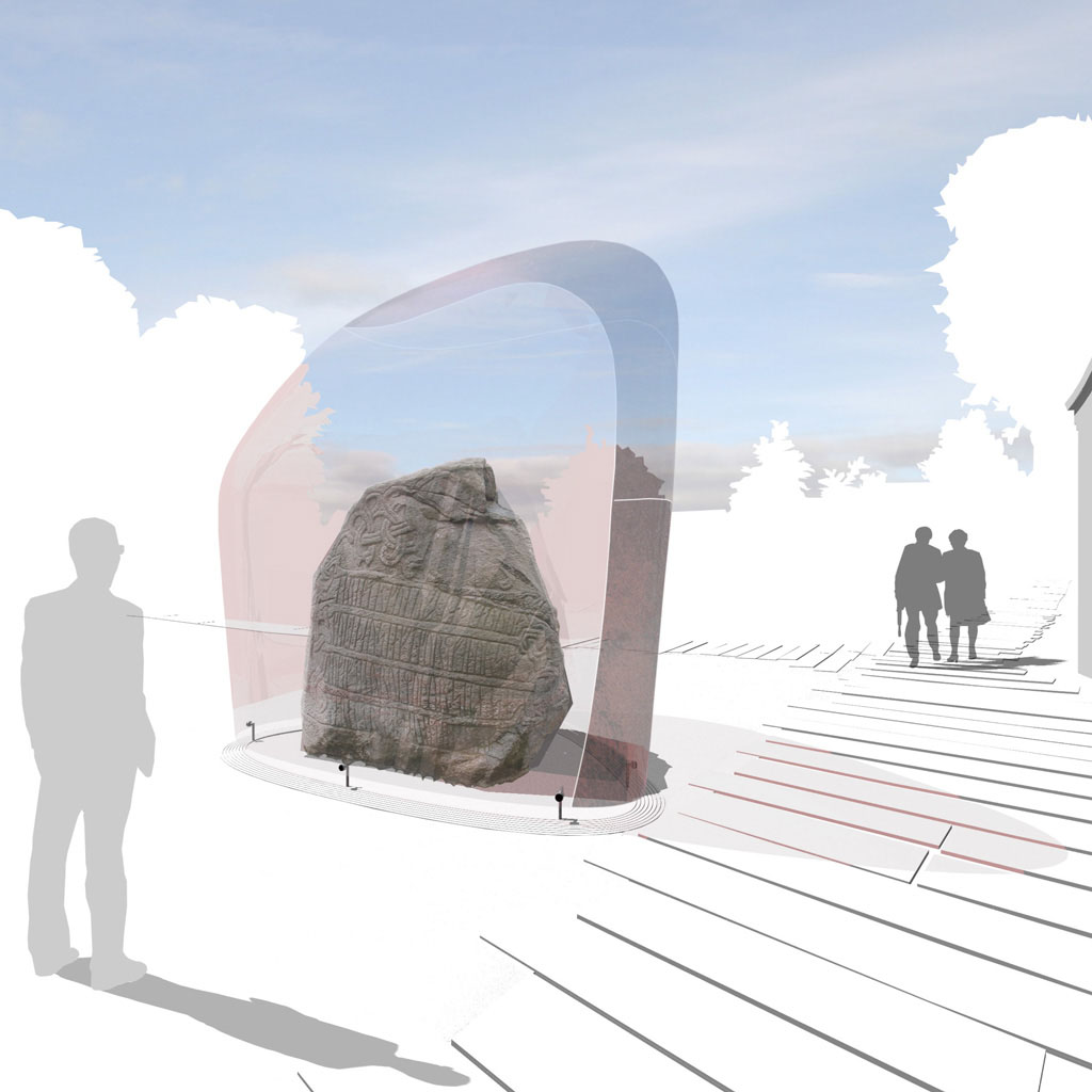
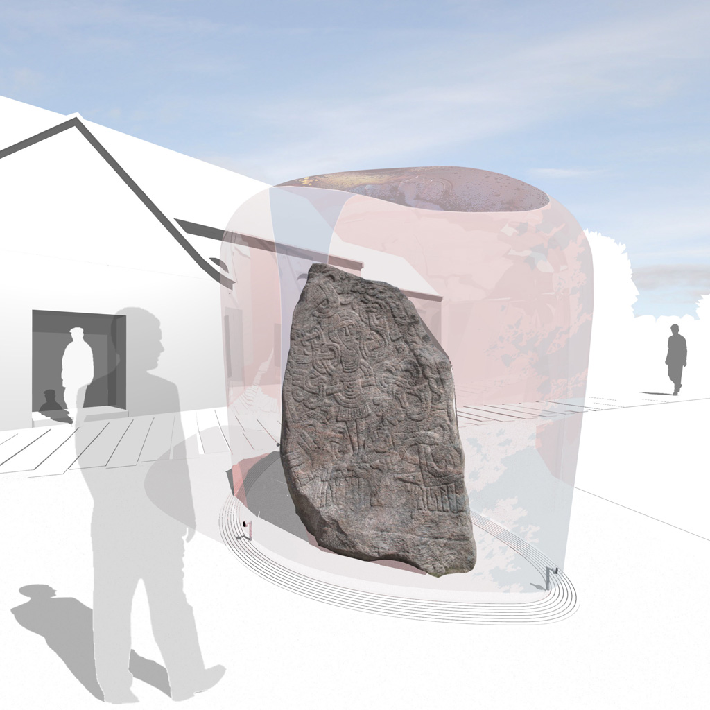
J_perspective2-2The smallest rock, which is not in its original position, is in great danger of deteriorating. The archeological advice is therefore to bring it inside a climatized building to prevent further deterioration. The bigger rock, in better condition, is placed under a glass canopy, naturally ventilated but weather protected. These are the simplest measures to provide the necessary protection while still keep the integrity of the monument site.

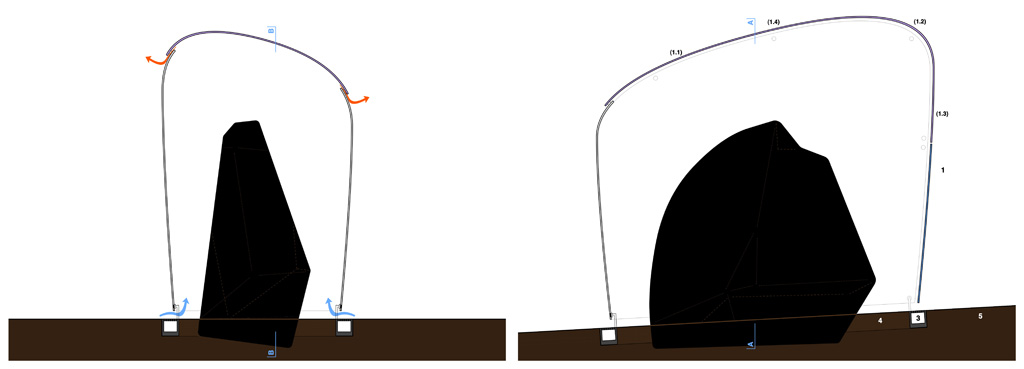
J_sectionsAll sides of the stone areclearly visible, and you can get in close to see the detail. The climatized screen protects against contact and vandalism. The screen is open and naturally ventilated so that there will be no condensation problems. Rainwater is handled through the construction foundation ring that runs along the glass canopy sides. The entire screen is produced off-site and lifted in place in one move, thus removing danger from operation processes on site close to the stones.

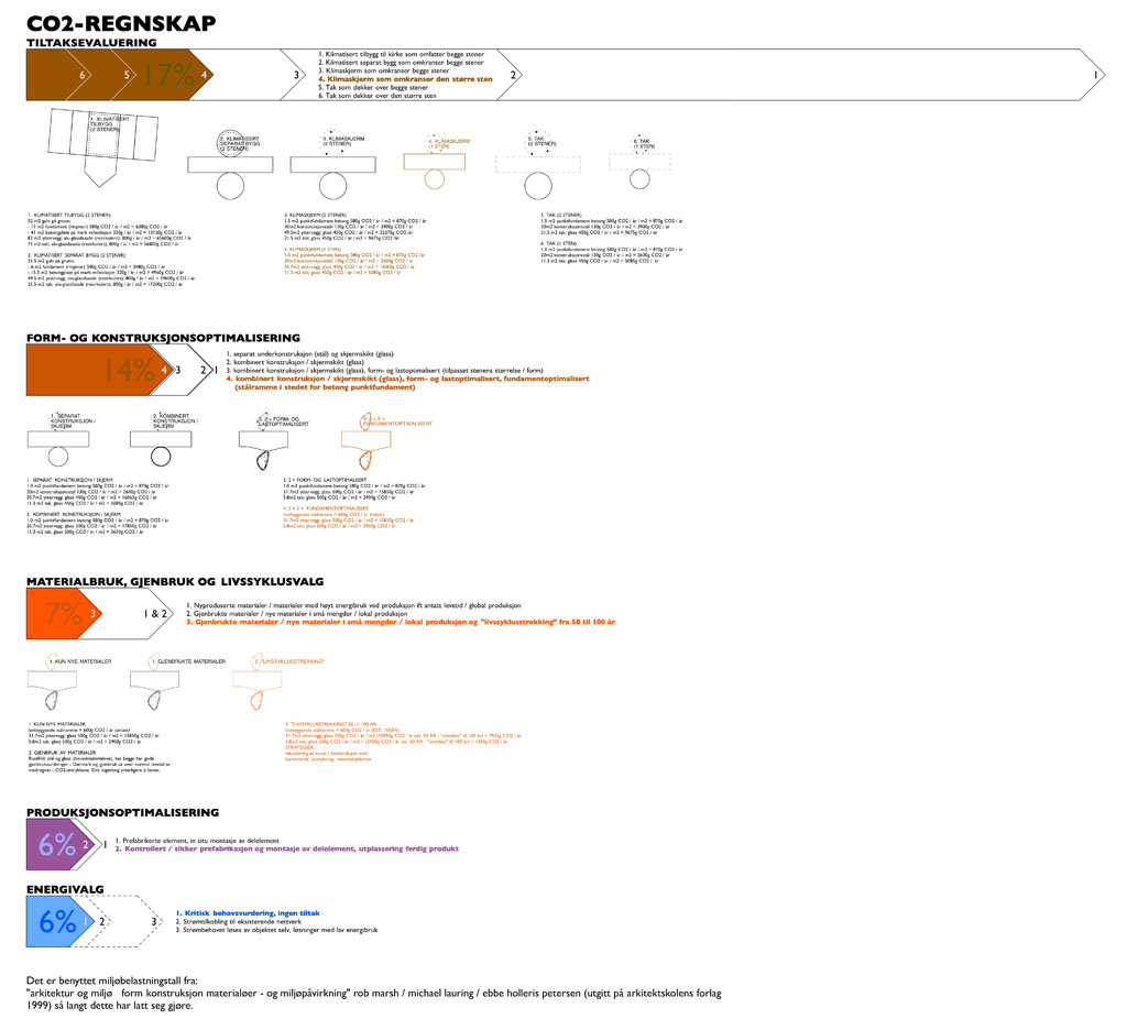
J_perspective3Throughout the development of the concept the main focus has been to reduce the CO2-emissions as much as possible. From critically evaluating the actual needs, through form- and construction optimalization, material / reuseability / lifecycle evaluations and product optimalization to energy supply and efficient lighting, the goal has been continuous monitoring and reducing the CO2 footprint. As the diagram shows, a significant reduction can be reached by making the right choices.

J_CO2footprint2