Ferry terminal and shelter on Viðey


«A precise and rough shape hides a softer inviting core when it is split in two, and when the two parts are placed on each side of the Videyjar sound, the perception of unity and familiarity is maintained across the waters»

The proposal was awarded 2.prize in the competition.

V_7VSP_f

CONCEPT // A precise and rough shape, which hides a softer inviting core when it is split in two. A surprising contrast between the rough natural exterior and the refined elaborated interior. The two parts (the boat house and the waiting shed) remains connected, and are perceived as a two parts of one entity, perceptibly unifiable and visually recognisable. By making a tilted cut in the precise shape you solve functionally both a covered outdoor area of the boat shed at Skarfabakka and a better entrenching of the waiting shed into the terrain out at Videy. The diagonal cut opens up videly and invites in both the passengers arriving by boat and the pedestrians coming to the boathouse to depart. Another benefit is the good overview achieved for the employees / boatdrivers, both towards land and sea. The glass surface between inside and outside becomes an interactive medium to communicate the day to day activities and history of Videy, as well as it can change to accomodate special events with other information needs. It would also be easily adaptable for educational uses.

VP_f

BOAT HOUSE // An organic line separates the closed spaces (toilets / storage / house technics) which doesn´t need natural light from the open ones (rest room employees / ticket sales / waiting area) which spaciously opens up towards the outdoor waiting area and the quay. For effective and flexible handling the ticket sales opens up both towards the outside and inside waiting areas. The soft organic lines of the interior makes horisontal breaks and displacement to create zones for sitting, benches and other interior solutions. The lighting concept underlines this horizontality. The waiting area is allways open to the public, while staff facilities and ticket sales are open periodically during the day, adjustable to the needs of the staff. One employee may have the complete overview of both interior and exterior spaces, and can thereby govern the hole complex.

V_5

WAITING SHED // The waiting shed is entrenched into the landscape where the information signs currently stand. Water run-off from the landscape are led in pipes underneath the outdoor concrete floor in front of the shed. The benches in the shed are terraced to make a mini-amphi for students to be educated upon arrival / before departure from Videy. The glass wall between inside and outside functions as a multimedia wall with projections when used for education of school groups. The waiting area is allways open to the public, but possible to close completely off during harsh weather conditions.

V_4

CONSTRUCTION AND MATERIALS, INSIDE AND OUTSIDE // Insulated and / or uninsulated sandwich in situ concrete, with different surface textures. Sandblasted dark concrete with dark basalt round river rock aggregate – the surface is drawn closer to the experience of natural rock. Ground dark concrete along the tilted diagonal cuts – to enhance the feeling of a cut deliberate action and a processed expression.

Ground and polished white concrete with white aggregate in the interiors – soft moulded shapes to create a tactile and bright inviting interior. Integrated low heat water heating in the benches. Structural glazing spanning from floor to ceiling.

V_8

Better facilitation for visitors at Geysir

«Kongsstien» is made up of minimal conceptual strategies – lifting the ground somewhat here, placing something lightly on the ground over there – in such a way that the magic of the place is preserved and that future kings may come to visit, be fascinated and leave again, just a little bit wiser.«

The proposal was made in collaboration with Handegaard Arkitektur.

G_1

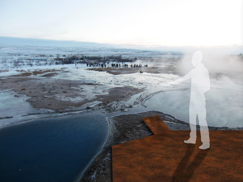
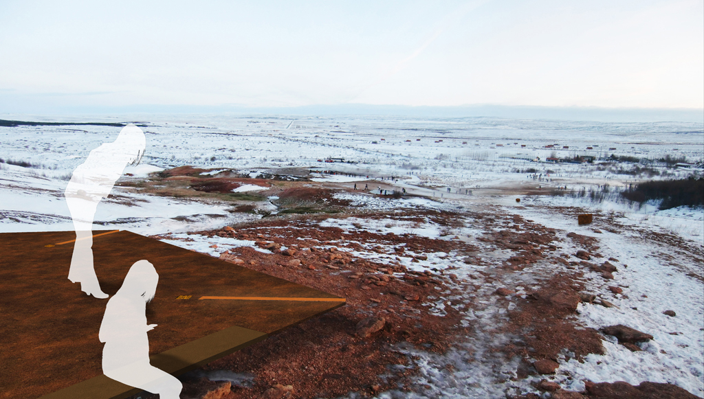
«Kongsstien» – coming as a stranger to a place of such awe, breathing and seething – at Geysir it really feels like you are closer to mother earth as a living, breathing entity, and that you are closer connected to her. To change a landscape like this demands respect, and the changes must reflect and subordinate itself to the existing – if not the Geysir area will loose the uniqueness of its connection to the inner earth. «Kongsstien» is made up of minimal conceptual strategies – lifting the ground somewhat here, placing something lightly on the ground over there – in such a way that the magic of the place is preserved and that future kings may come to visit, be fascinated and leave again, just a little bit wiser.

G_P1

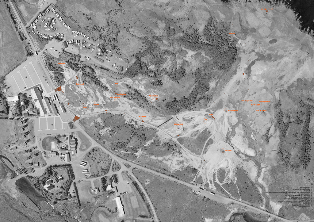
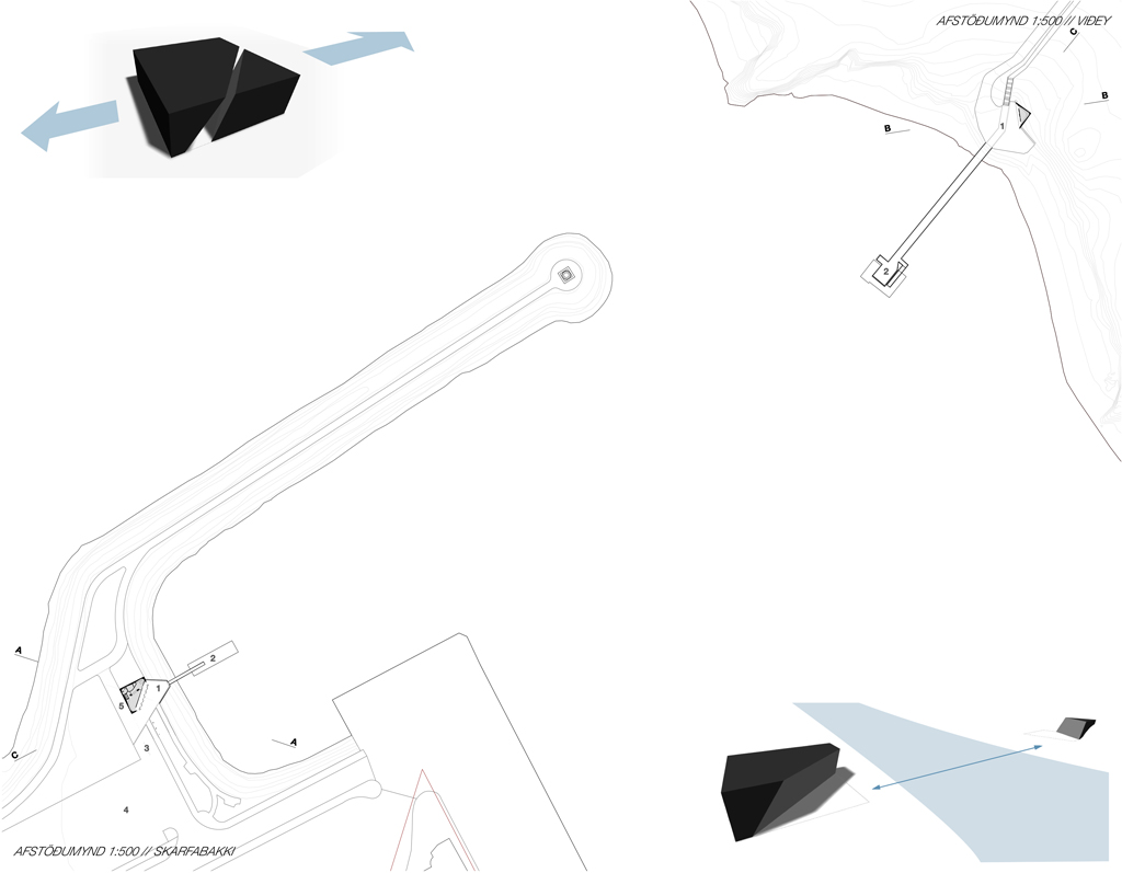
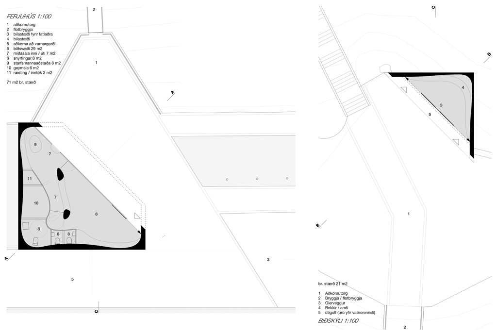
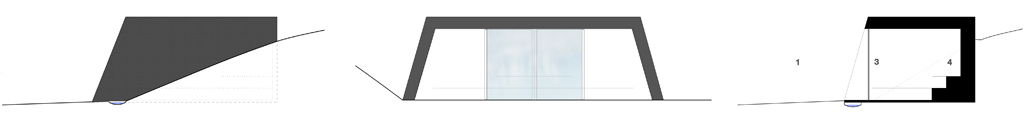
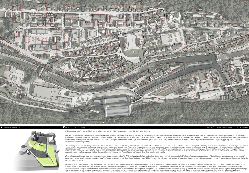
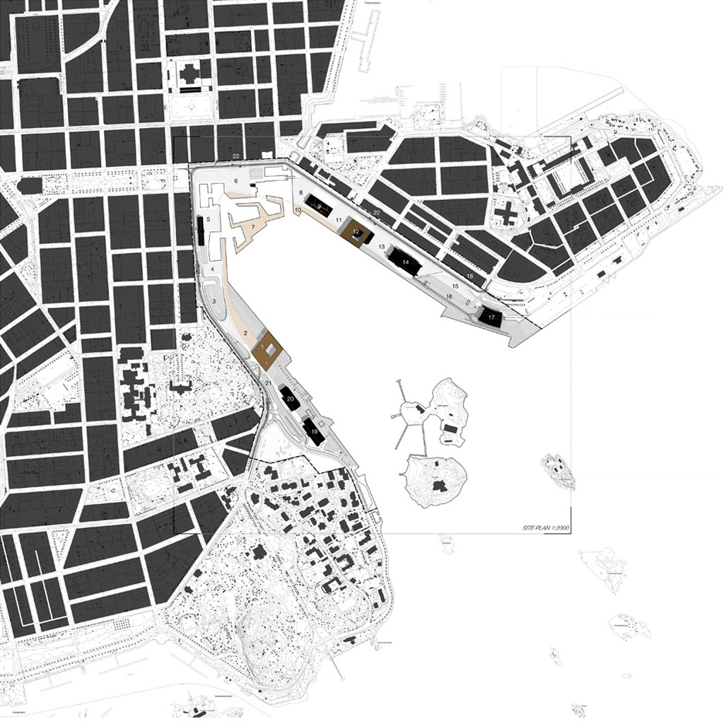
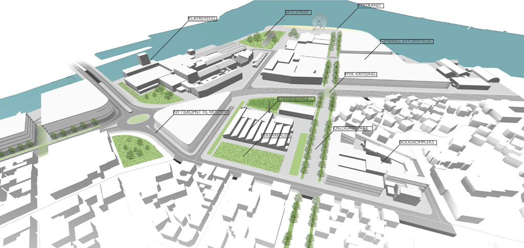
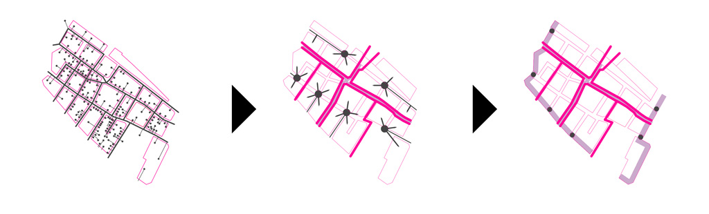
UNDERSTANDING OF PLACE // The Geysir area is today characterized by step-by-step development and no unifying impression that greets people. The extent of the conurbation is in the competition proposal defined by a new public bath on the western edge of the main parking, partially entrenched in the landscape. This gives a two-sided access and thereby better use of the main parking lot. The entrance to the parking lots are placed as early as possible, both to the east and west. This enhances the public flows securitywise, and leaves a minimum of vehicular traffic at the crossing points at Geysistofa. The two main entrances to the geothermal area defines a shared space, where vehicular traffic and pedestrians are mingled.

G_3

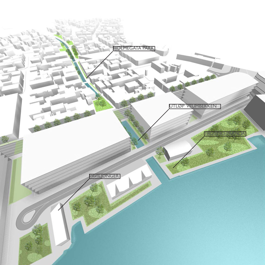
The deserted farm Laug can be redeveloped for tourist rental with a strong focus on environmentally friendly tourism as a self-sufficient summer cottage complex. This would be a perfect advertising board for similar deserted farms in more spectacular secluded locations, self sufficient in the same way. The fence surrounding the geothermal area is repositioned to the west, when the shortcut from the camping site is integrated into the pedestrian system of the geothermal area. The fence is also repositioned so that you can reach the top of the Laugarfell mountain still within the perimeters of the geothermal area. Ticket sales are handled either in the service centre or through ticket machines on the southern side of the road close to the parking lots, thus preventing large concentrations of people out in the road. Automated entrance control with ticket scanning further facilitates quick access to the geothermal area on the northern sid of the road. The ticket system will be adapted to the national strategies for payment at tourist sites in the Icelandic landscape – i e the «naturpass».

G_P4

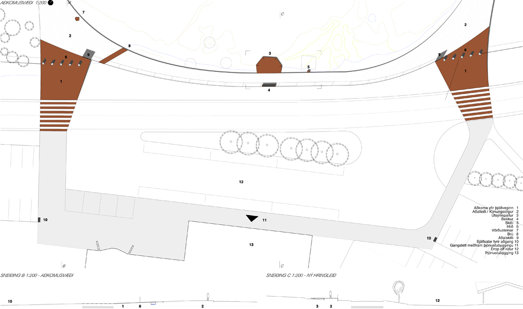
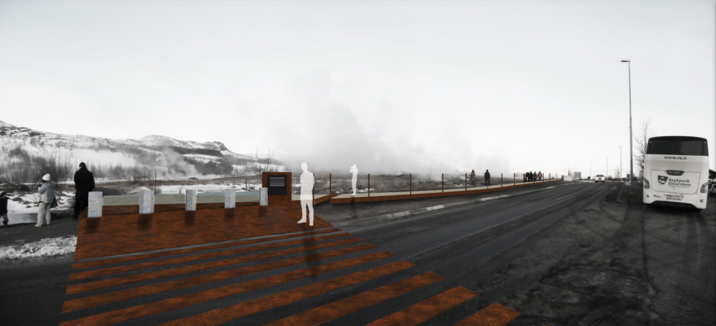
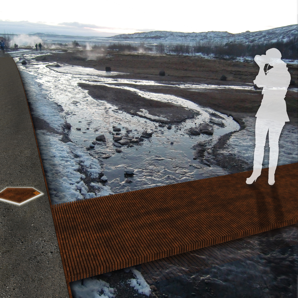
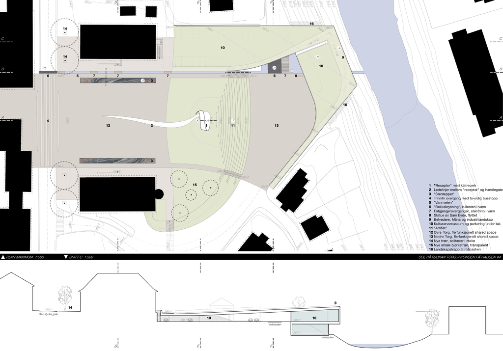
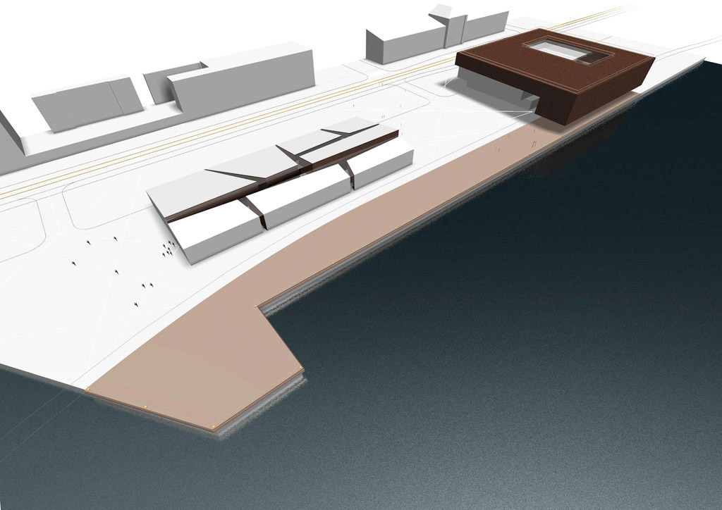
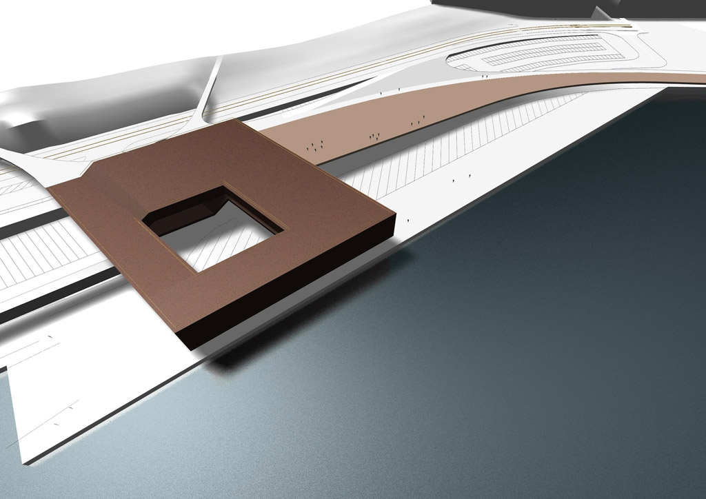
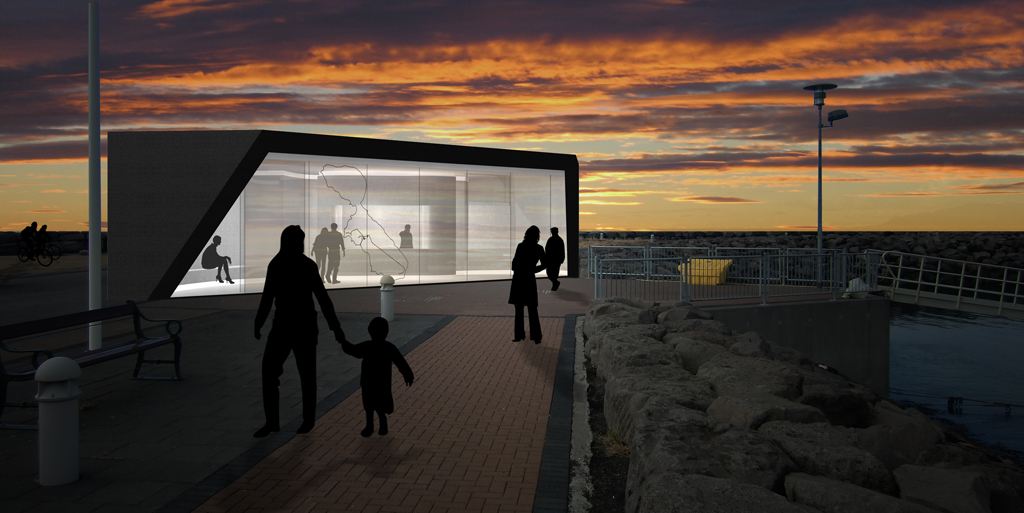
ENTRANCE TO THE AREA // From the big parking lots you move as a pedestrian unhindered along the service centre, whether you come from the west or the east you can choose either between the existing or the new entrance. Two «surfaces» come down from the geothermal area and invite you in, made from cor-ten steel plates embodied in the asphalt. They split to individual lines as pedestrian crossing and continues into the geothermal area as one continuous plate. The new crossings defines a quieter zone where toueist busses has their drop-off zones and vehicular traffic in general is kept on the pedestrians terms. A continuous pedestrian zone binds the two crossings and the entrance to the service center together, as well as the materiality of the shared space is changed to slow speed and indicate that the pedestrians are prioritised.

G_P5

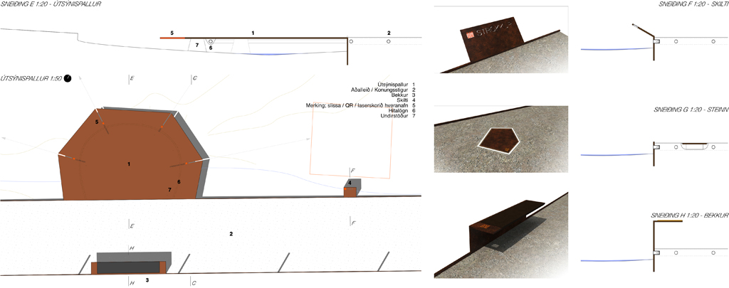
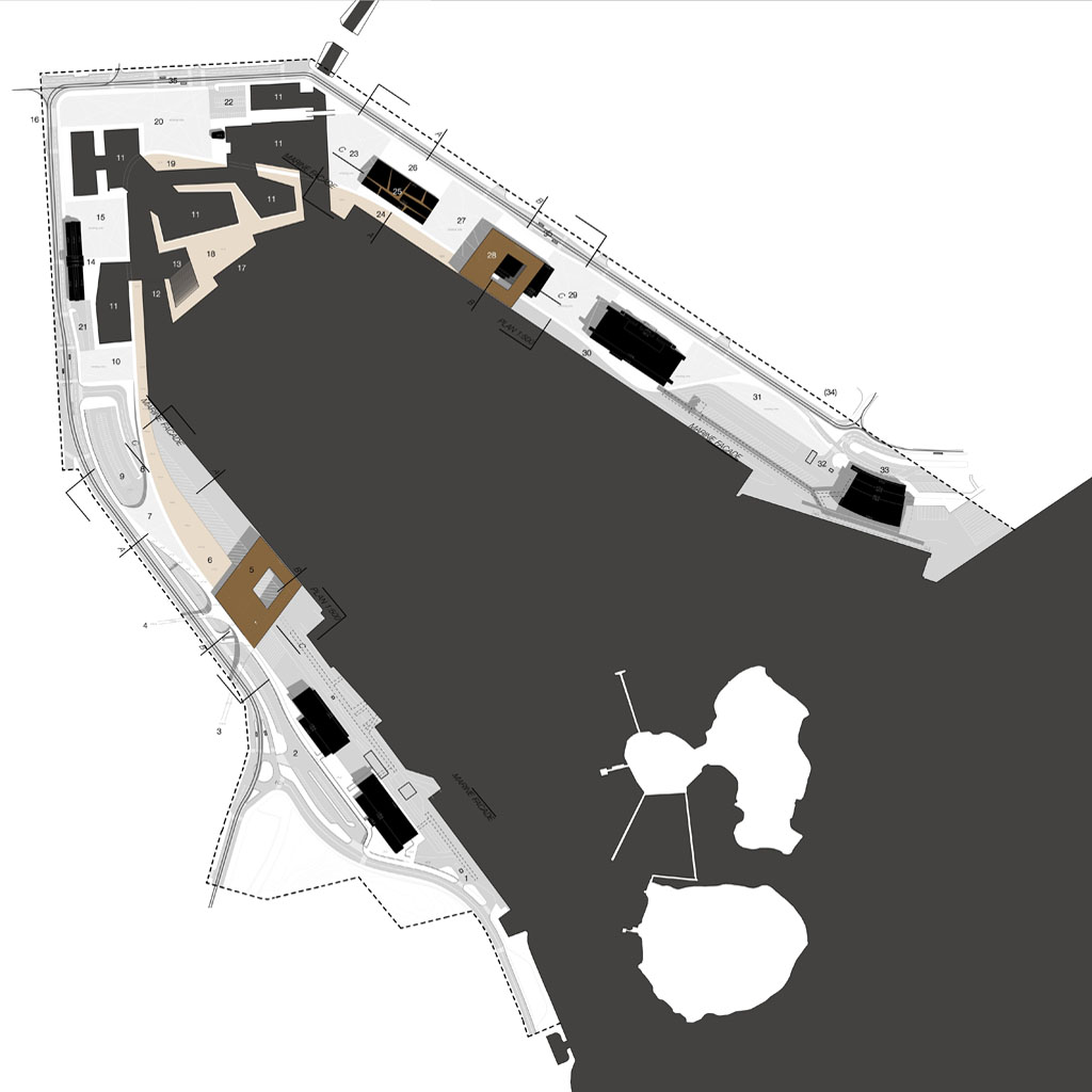
FLOWS WITHIN THE GEOTHERMAL AREA // Within the geothermal area is established a new ring road, and by positioning the new pathway on the northern side of Thykkvihverir you get a better overview of all the smaller pots here. In addition the new pathway gives access to the hotter springs which you can´t reach today. The ring road is water heated and ice-free, and makes a relief to the ground made of sandblasted concrete, with aggregate of the same colour as the on-site sand and gravel. A secondary crossing path is executed as a cor-ten steel rib structure also water heated by the flexible pipes which binds the ribs together – these ribs functions as an ice-free carpet laid out over the wet areas and let the overflowing water run through while you pass over dry. The paths to view-points, Laugarfell top and the Kings rocks are visually enhanced with abstract cor-ten «rocks» as guiding rocks as markers.

G_5

ELEMENTS // The ring road: surface relief in sandblasted concrete with cor-ten steel edge as guide line. / Secondary crossing: «carpet» og cor-ten steel rib structure./ Sightseeing platforms: Cor-ten steel plates with slits marking directions to springs / Bridges: Cor-ten steel plates covering small streams where they cross the ring road./ Main sign: Bigger cor-ten steel plate vertically extended from the edge with area description. / Signs: Tilted signs made of cor-ten steel plates, attached to the edge. / Bench: Cor-ten steel edge extended and bent to facilitate sitting with a / Guiding rocks, embodied: embodied cor-ten plates with edge illumination / Guiding rocks, free standing: Cor-ten abstract rocks along secondary paths / Fence towards the road: The Cor-ten edge is extended to form pillars for steel mesh.

G_P3

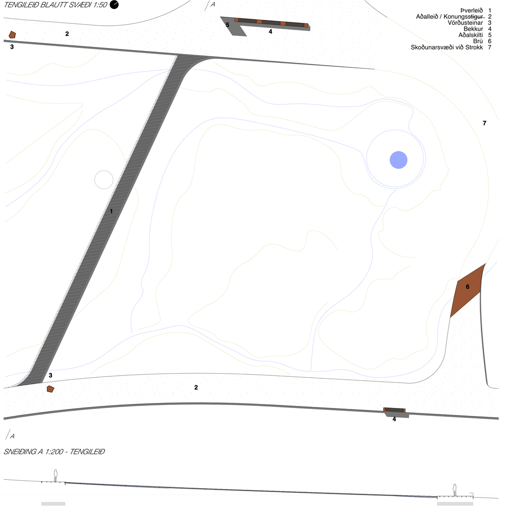
The new ring road forms a new loop which circumferes the hot spring Blesi. All elements attaches themselves to this new main loop – the sightseeing platforms are bent out from the edge, the benches and signs are extended and bent from the edge, the guiding rocks are embodied into the road surface or placed onto the terrain guiding along the secondary paths. The crossing south of Strokkur is also a highly visible secondary path, which functionally lets the water run through and under it. The pathways to Konungshver / viewpoint / Konungssteinar / Háihver / Laugarfell are less used and the free-standing rocks are enough to guide the visitors through the landscape and prevent damage to the terrain.

G_P2

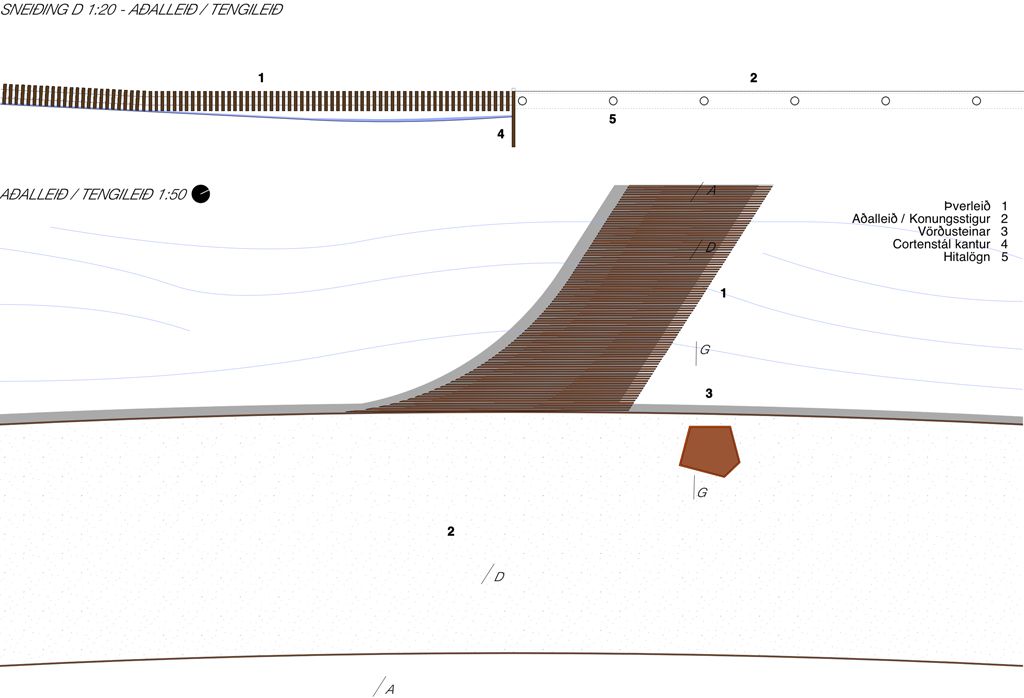
MATERIALITY // Few, but robust lasting materials, are chosen to blend into the surroundings and avoid greater visual impact. «Gravel roads» made from sandblasted in-situ concrete, with aggregate of locally collected materials to further blend into the landscape. The ring road is percieved as a relief to the slightly undulating landscape. Water pipes run through the pathways, thus preventing ice and slippery conditions for unprepared visitors. Cor-ten steel as contrast material makes up the edges / wetland paths / sightseeing platforms / signs / benches and guiding rocks. Flexible water pipes are also used as the structural element for the cor-ten steel ribs of the wetland pathways, and underneath the sightseeing platforms. Fluorescent painted text and lines / QR-codes as visual contrast for signage and presentations.

G_2

COMMUNICATION AND EDUCATION STRATEGY // To avoid many large signs with plenty of text scattered around the area, it is suggested to place one main sign at the entrance / exit points which explains more thoroughly the geology and history of the geothermal area with written text. At every point of interest there are instead placed name-signs with an additional unique QR-code that takes you to a web-site with more specific information about each hot spring. Such an interactive digital solution is also more suitable to use educationally, where for instance school classes can use the web-site both for preparation and post visit assignments and information gathering. The QR-codes are painted on transparent plastic plates, embodied into the cor-ten metal signs, so that they are changeable if needed.

Rehabilitation of Rjukan Torg

R site planThe open competition to redesign the town square of Rjukan, to welcome the new sun reflectors rays that gives the Rjukan inhabitants a glimpse of the sun during the 6 months in the shadows throughout winter, was held in march 2013. With approximately 100 participants, the competition attracted a wide range of nordic proposals.

R planThe main composition includes the transformation of the upper and lower squares, and an elaboration of the green field inbetween including the sun receptor (an activity sculpture) and down to the lower square as an amphi theatre. On the other side of the lower square, out into the river landscape, there is a new world heritage museum, thus activating the 4th side of the extended Rjukan torg. The field of green also extends out onto the roof of the museum as a belvedere in the same river landscape, and with a ramp it connects down to the lower square. The museum and ramp encloses the lower square, making a suitable stage for performances and concerts, together with a distinct entrypoint to the museum. Stretching from the upper square all the way down to the Måna river is a water passage, linking the new elements together.

R plan minThe green activity field is designed as a small hill-top, where the sun receptor is placed, giving it the most prominent position in the composition of squares. The light-and-activity sculpture is drawn away from the town square to keep the square surface a flexible space for both market days, festivals and other events. The sun receptor casts shadows, can be used both as a playground and a stage, flexible and changeable.

R overviewThe upper square is stretched over the main road all the way up to the commerce street in Rjukan, thus creating better accessibility accross the main road passing through the square. New buss stops are located directly on the square, thus giving pedestrians priority over vehicles. To further underline the switch in priority, the water passage starts as a water crossing with cobblestones on the road, to reduce the speed of cars. The water passage runs all the way to the Måna river, including stone bridges, a small waterfall inspired by the

R sun receptorThe square is left mainly untouched, except for two stone carpets separating the entrance zones of the town hall and library buildings towards the center of the square. The stone carpets are multifunctional elements; for sitting, climbing, laying down and even skating. The carpets undulates to open for passages across from the square to the buildings where this is necessary.

R stone carpetsAcross the square there is also drawn a guiding line with technical infrastructure which binds together the commerce street with the receptor. At the commerce street end of the guiding line there is a miniature light sculpture to invite people in main street down to the town square.

R amphi theatreThe existing lower square is separated from the upper square by a small slope, which is transformed to an amphi theatre with the lower square as its stage. The lower square is transformed to a shared space, with occasional parking but at special events closed off as pedestrian space. The water passage widens at the end of a small waterfall at the entrance of the new world heritage museum. Her Sam Eyde finds his new place.

R water passageThe water passage is integrated in the museum design and continues all the way across the Måna pedestrian trail down to the Måna river. The museum is divided intwo levels – an upper level with the entrance from the square, closed towards the river but opens up parallel to the river – and a lower level at the same hight as the Måna pedestrian trail, opening up towards the river. The entrance level also includes a westerly oriented café / restaurant.

R museum

Motto Portal

P_southharbour_b

When walking through the South Harbour area, the instinct reaction is that the area is quite well functioning. The port activities with its passengers, vehicles and cargo is strangely intertwined with softer public use and serves as a basis for the lively, rough feel of the area. In other words, the percieved problems with shore access, traffic and parking are necessary «evils» that support and enliven the inner harbour activities. So how to go about changing the area without removing its character and the basis for it?

P_southharbour_cityareaThe approach to the area is lightweight: subtle changes to the traffic flows and new elements to the areas add an extra layer to the already existing fabric, supporting a softer and more humane environment. Wood is chosen as a signature material for several reasons; it is a good carbon storage medium, and it will support the homeland industries through innovation. It also brings a warm contrast to the larger asphalted existing surfaces. Each of the suggested projects can be sustainably optimized, consolidated through further detail planning and certification of the building process. The lightweight strategy per sé is sustainable in a longterm perspective by reducing consumption.

P_southharbour_planBy introducing stacked parking in the vicinity of the terminals, most of the parking lots in the inner harbour can attract new activities. Also introducing a new soft pedestrian route along the entire inner harbour shoreline the open spaces can be used for instance as free-market space, festivals grounds etc, or be activated by their adjacent buildings. To support even further public use in the inner harbour a new lightweight wooden activity field gives direct access to the water through a small «beach» (for toedipping) and includes an elevated pedestrian footbridge, a diving tower / viewing platform, and leisureboat basins. The soft network is supported by a new tram line that runs through the Esplanadi park from Katajanokka K8 terminal, stopping at the Katajanokka K6 (new day-visit cruise terminal and art museum) and at the Kauppatori market. This unites in an environmentally friendly way the whole of the South Harbour area. The main traffic flows of vehicles and cargo is shifted, from being all through the inner harbour area to a two-way periferal system. The Olympia / Makasiini traffic is redirected to the south west and connected to the western harbour areas of Helsinki. The Katajanokka cargo terminal is likewise redesigned and the traffic is redirected through gate C. This leaves much more of the north-eastern shoreline open to the public.

P_southharbour_kThe existing buildings on Katajanokka have a distinct character, and the approach to the area introduces both transformations and additions. The existing asphalted areas have been kept and surface elements (such as landscaping elements in the park) are additions on top of the existing surface. The street section has been redesigned to facilitate more immediate drop-off / temporary parking on the cityside, the new tramway in the middle and an extended green park on the waterside. The surface parking is relocated to the Katajanokka K8, in close walking distance. The shared spaces between the harbour buildings provide new entrances to the buildings, drop-off and temporary parking. Because of the low traffic intensity, there are no problems mixing the different user groups with vehicular traffic through surface design solutions and signage. Along the waters edge is a new wooden esplanade, slightly elevated (+2.5), which takes the visitors from the day-visit cruise terminal and museum, through the new waterside activity field past the Kauppatori to the new Makasiini terminal.

Instead of demolishing the Kanava terminal building it is transformed through low cost incisions, making room for a flee market with many small vendors. The K6 harbour building is the Katajanokka portal building and the boundary towards the traditional harbour areas. It is designed by added built mass, which architectonically plays together with the new Makasiini terminal on the western side of the harbour. It mixes the art museum and the day cruise terminal with an outdoor covered sculpture garden in its center.

P_southharbour_maakasiiniA new hybrid building containing the new Makasiini terminal solves many of the conflicts in the area. By improving the access and proximity to the waters edge for the public, and making a new movement pattern for pedestrians and bikers along the shoreline (avoiding conflict with vehicles), the new terminal and its «hillside» esplanade redefines the way people move through the area. The new terminal building also makes room for 500+ new  in house parkingspaces. The extended drop-off zone of Olympia and Satamatalo concentrates the arrival and departure traffic to the terminals at one location. There are many benefits from demolishing the existing terminal: By stacking the flows and user groups vertically, the cargo handling zone comes closer to the water with direct access to the ships. The public wooden «hillside» esplanade with overview over the harbour area offers a number of new activities to the public. The new terminal roof contains an urban park and belvedere over the whole harbour area. The park landscape of the Tähtitornin Park extends out towards the port area and becomes the visual link between the city and the harbour.

The new Makasiini terminal building provides both passenger terminal facilities and the link to the access structures to the Ferries of the Olympia terminal. The warm wooden surfaces serve as the identity that binds the new terminal end esplanade together with the inner harbour activity field and the new transformations at Katajanokka.

Områdeprogram Floa

FLOA_visual_OslogataThe strategic planning programme for the Floa area in Fredrikstad is a preliminary strategic planning document, prepared for the Fredrikstad municipality, and is now undergoing political evaluation. The goal of the final revised version of it, is to form guidelines for the development in the Floa area and be a common ground and a starting point for discussions on new initiatives here. The programme was first presented for the politicians in late August 2012, and the evaluation process through this autumn will end in a formal decision making process, hopefully in early 2013. It was prepared in collaboration with Griff Arkitektur as.

FLOA_v_H nyThe document contains: a status report on the different public plans for the area and their relevance today / a status report on the fragmented private initiatives and their relevance today / a summary of the different owners´ present needs for development / a set of development strategies that tie together the private and public needs / sustainable development strategies, with the focus on reducing CO2 emissions / a toolbox for the above mentioned sustainable development strategies / visualisation of the inherent possibilities in the area / a guideline for the following planning processes, their extent and timelines.

FLOA_sust_blocksThe overall environmental philosophy is based on a reduced, timeline-defined and optimized approach to planning. The municipality of Fredrikstad has made national commitments, and set themselves high ambitions, to reduce CO2 emissions through planning. The Floa area is one of the strategically important areas in Fredrikstad with a great potential, thus the overall philosophy focuses primarily on key points to achieve these goals. By critically evaluating needs, and continuously optimizing the solutions throughout the processes and projects, the best possible reduction of CO2-emissions can be achieved. Life cycle evaluations and timeline evaluations should be implemented in the future planning processes, as well as the documentation of the material- and energyflows, in and out of the future projects. Sustainability certification can spur owners to create a higher quality built environment, which in the end will benefit everyone and be more attractive on the market.

FLOA_sust_infra nyThere are suggested tools for lowering CO2 emissions – ranging from the planning stage and administration of the processes / projects down to the execution of each individual project. In the planning stages, the focus is mainly on detailed high ambitions pared with demands for documentation. Setting high standards and sticking to them throughout the process is essential. In the execution stages the focus is on critically evaluating the demands, and finding smart solutions in accordance to the predefined high ambitions. To reuse the existing urban fabric to a high degree (both buildings and infrastructure), to reuse instead of transforming, and to transform in stead of substituting are essential evaluation criteria. And when substituting, follow the energy- and materialflows out as well as in.

FLOA_healthThe more spesific development strategies for the Floa area and the adjacent Holmen area include a redefinition of the diverse traffic movements through the area, a new health and activity triangle, public programs to activate it, a temporary / permanent marina, riverside beach / parks / walkways, a new soft network thoroughfare along a reopened canal, and a bouleward park also connecting to the riverside public areas. Several of these strategies and projects are visualized to show their inherent potential.

FLOA_activity ny

Motto I

EpleI_concepts g«En by å leve i» (an international urbanism ideas competition for the Strømsø area in Drammen) was held in spring 2010, with a strong emphasis on sustainable development and the reduction of CO2-emissions through planning. It attracted 41 submitted proposals. Because of accute illness in the final stages of the competition, this proposal was not finalised and submitted for evaluation. The winners of the competition was «Look to Strømsø», a proposal by Norconsult and Alliance Arkitekter, an excellent proposal concerning CO2-emissions reduction strategies.

EpleI_concepts spesificStrømsø has a very strategic position in Drammen, in the city centre with both local and regional transportation hubs within its boundary, and is an ideal site for strategic choices to create a sustainable future development. Key issues are to reduce vehicular traffic, increase soft movement and create a denser urban fabric with greater environmental qualities.

I aims at an overall densification through the act of inversion:

– inverting the city and the landscape: reintroducing the green in a creative way in the denser urban fabric, both horisontally and vertically.

– inverting the grid: reducing vehicular traffic to a minimum an co-locating accesspoints to bigger entities, to make way for street parks and soft paths instead of car traffic.

– inverting the blocks: transforming backyards to walkthroughs and doublesided accessible space with an internal soft access – thus increasing the density in each block (learning from the transformation of Venice).

EpleI_grid optimalizationThe main development strategy consists of introducing densified uilt mass along the main roads, as a present-day «city wall», and at the same time locating fewer accesspoints and parking to these larger structures. Within the «city wall» the densification follows a neuanced timeline, at the scale and pace of the existing blocks and building structures. The inversion of city – landscape, grid, blocks and buildings increase soft movement, reduce vehicular traffic to a minimum and enhance the quality of the public spaces, while at the same time increasing the density. The main strategy focuses rather on reuse than transformation, and transformation rather than substitution, and thereby minimizing CO2-emissions.

EpleI_surfacesThere´s also set up a transformation scheme of different surfaces in the urban fabric, each surface given a colour of definition, where the goal is to transform as many of the surfaces as possible to better environmental performance:

– reducing the blacks: The black surfaces are for instance asphalt and other hard surfaces on the ground, inactive roof surfaces and also inactive facades with poor environmetal performance.

– reducing the greys: The grey surfaces are undefined in-between surfaces that mirror their adjacent surfaces, and can change their sustainability performance with the changes of the adjacent surfaces. Examples are small green spaces in hard surfaced cityscapes, which are given new value and are easily integrated when these cityscapes are transformed to for instance a street park.

– adding greens: The green surfaces are green organic surfaces with CO2 storage capacities and local climatic effects and quality enhancers, as well as surfaces with the ability to delay the impact of for instance excess rainwater to the drainage systems.

– adding blues: The blue surfaces are energyproducing surfaces, either passive (glass) or active (solar panels). They could also be energy storing surfaces like for instance water basins.

– adding whites: The white surfaces are reflective surfaces, reflecting light and heat to create brighter public cityscapes and reduce overheating of the built structures. They naturally find their place where conditions are not right for either the green or blue surfaces.

EpleI_vertical blues